Impact of anthropic activities on biodiversity along the shoreline: development of coastal occupation
The coastline is a link between land and ocean that has been subjected to strong anthropization (i.e. the transformation of the environment due to human presence or action) for centuries. 40% of the European population lives in coastal areas, rich in biodiversity, industry, culture and heritage. The TRaversing European Coastlines (TREC) / Tara Europa expedition aims to explore European coastal ecosystems over the coming 2 years (2023-2024) to better understand the interactions between the two main ecosystems of our planet: land and the ocean.
What is the shoreline?
According to Michel Desse, professor of human geography of coastal areas at the University of Nantes, the shoreline is an interface zone between land and sea/ocean that fluctuates depending on the day (under the influence of tides, for example), season and climate-related events, such as marine submersion. In some places, the coastline can expand up to 10 kilometers inland due to human activities (e.g., port area, seaside resort).
France is the second largest maritime territory in the world:
- 5,500 km of coastline in metropolitan France
- 2,000 km of coastline overseas
- 975 municipalities bordering sea or ocean
- 237 communities bordering a lake or an estuary.
In France, the loi Littoral (Coastlines Act), promulgated on January 3, 1986, aims to preserve coastal ecosystems while controlling the growth of economic activities and sustainable development of coastal territories. It concerns more than 1,200 municipalities bordering the sea/ocean, but also large lakes, estuaries and deltas. Its objective is to reconcile coastal preservation and development in these areas confronted with urban pressure, erosion and marine submersion.
Under the Coastlines Act (article L. 321-2 of the Environmental Code), the shoreline encompasses all coastal municipalities:
- bordering the sea or the ocean, salt ponds, inland bodies of water covering an area greater than 1,000 hectares
- bordering estuaries or deltas when they are located downstream of the water salinity limit and contribute to the economic and ecological balance of the coastline.
40-60% of the world’s population lives in the vicinity of the coastline
To be precise in this estimate, it is necessary to include the coastal strip, the connecting area between land and sea/ocean and the coastal region, i.e. a 300-km wide stretch of the mainland. Indeed, the majority of the world’s major cities were built along the coast.
However, the distribution of the coastal population is not homogeneous. In France, the Cotentin coastline (Normandy), the tip of Brittany and the Landes (Nouvelle-Aquitaine) are sparsely populated areas. In contrast, the French Riviera (Provence-Alpes-Côte d’Azur), the shoreline of Vendée (Pays de la Loire) and Charente (Nouvelle-Aquitaine) are very populated.
The coastline is an attractive geographical area (jobs, leisure, lifestyle, etc.) that offers a certain quality of life.
How has the shoreline changed in recent decades?
Man has always lived close to the coast. Historically, the coastal area has been an attractive territory.
First, an economically attractive territory
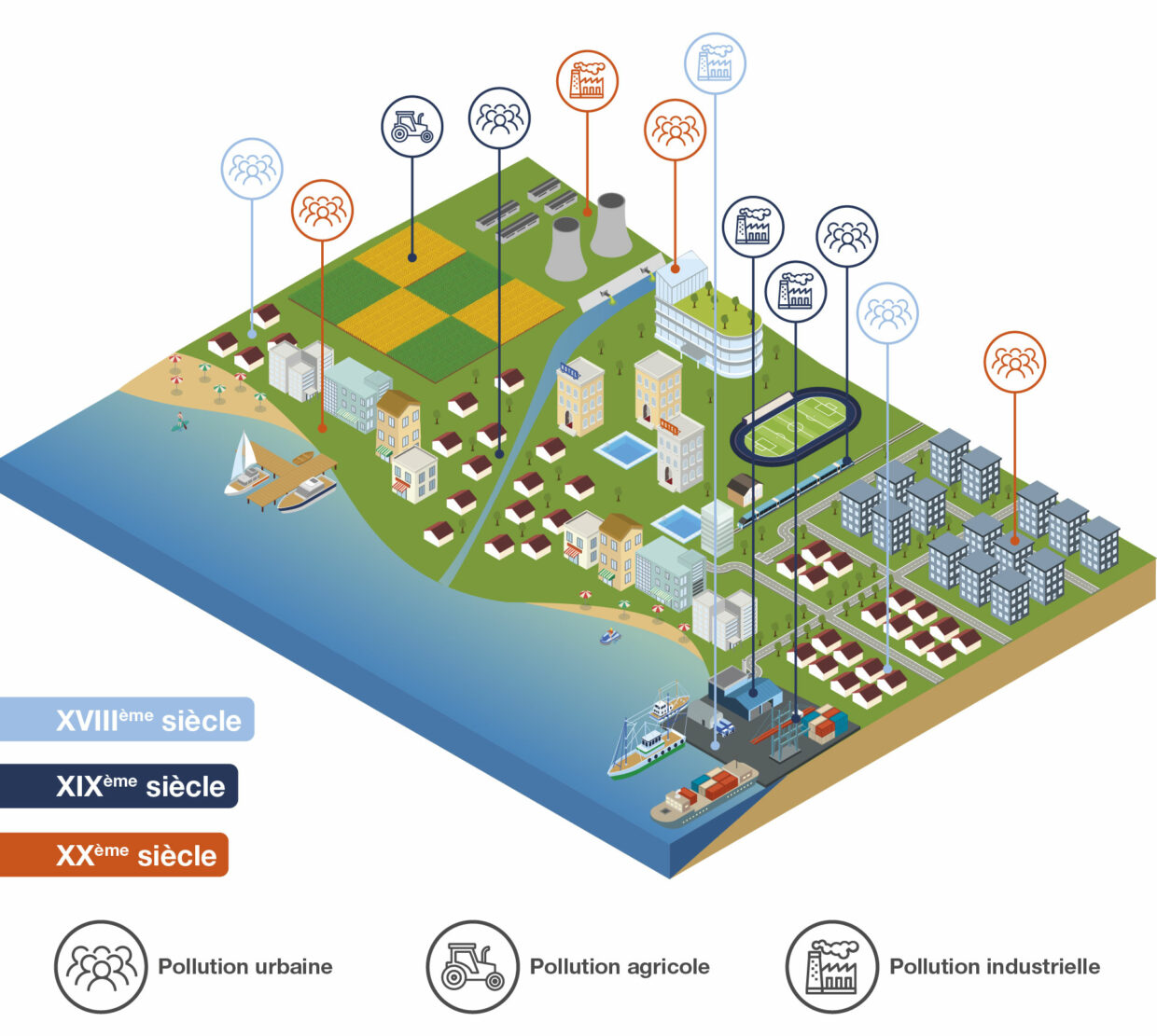
In Europe, coastal occupation first intensified in the 18th century with the beginning of colonization and construction of major commercial ports that facilitated triangular trade and imports of goods.
Then again in the 19th century with the development of settler colonialism, new ports were built in the colonized countries. These ports developed and became new cities (Dakar, Abidjan, etc.). At the same time, coastal activities grew thanks to technical advances, such as railways and canned food. Progress made it possible for fishermen to export their catch (sardines, tuna, cod). This is referred to as coastalization, an increased growth of activity along the shoreline.
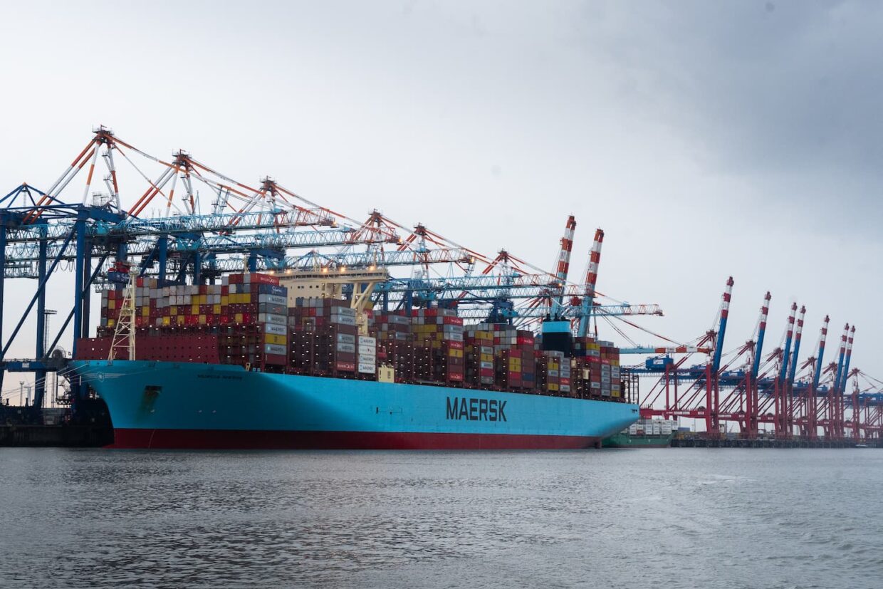
In 1970, coastlines became the support of globalization. Ports experienced an unprecedented expansion and became a gateway for the massive development of import and export (Rotterdam, Dunkirk, Fos-sur-Mer, etc.).
In the 1990s, a number of coastal cities, such as Brest (Brittany), Nantes (Pays de la Loire) and La Rochelle (Nouvelle-Aquitaine), developed around research and innovation, building universities and research centers.
Now, a touristic, leisure-oriented territory
Since the end of the 18th century and more particularly in the 1970s, tourism has increased along the European coasts with the creation of seaside and tourist resorts. These coastal areas, popularized by tourists, gradually became lively cities.
Tourist activity intensified to the point where it is referred to as mass tourism. To accommodate these new waves of tourists, large seaside resorts were built, often in places where there was no other infrastructure before: Dinard (Brittany), La Baule (Pays de la Loire) and Deauville (Normandy), for instance.
What are the impacts of these activities on biodiversity?
All these changes in land use to host new activities along the coast impact biodiversity. Leveling dunes, backfilling ponds and removing natural areas unbalance ecosystems. Let’s take the example of dunes, these ecosystems dissipate storm energy by changing the profile of beaches through sediment displacement. By removing them, we expose ourselves to certain risks.
Coastal artificialization destroys natural areas and their biodiversity to replace them with artificial infrastructure made of concrete. In the 1970s, the very large port developments reshaped the coastline, leading to the destruction of essential ecosystems.
In addition, the expanding and intensifying activities generated various pollutions. The population density of coastal cities and intense maritime traffic in ports caused noise and light pollution that impacted marine life. Indeed, noise pollution prevents marine species from communicating and thus disturbs their balance. Maritime traffic also generates specific pollution, such as the transport of invasive species, in particular with the release of ballast water.
Pollution that does not come only from coastal activities
The coast lies at the end of an aquatic continuum composed of a multitude of interconnected ecosystems that follow one another:
- streams
- wetlands
- ponds
- rivers
- estuaries
- coastal areas.
It is therefore the collection point of all the pollution generated upstream, carried by rivers and catchments areas. As a result, these contaminants, which penetrate our lands and rivers, end up on the shoreline and impact all the interconnected ecosystems of the aquatic continuum along the way.
There are three major pollution categories:
- Urban pollution: The concentration of population generates pollution flows through gutters and wastewater treatment plants that cannot filter everything. Pharmaceuticals, for example, which are ingested by humans and then discharged into wastewater, are not fully treated by purification centers. Wastewater management is not homogenized and some European cities still do not treat their wastewater.
- Agricultural pollution: Agricultural activities are the source of chemical and organic pollution linked to the use of fertilizers and pesticides that infiltrate into the soil through irrigation and end up in rivers. Similarly, industries located along rivers release pollutants.
- Industrial pollution: This pollution has also many sources. It includes the discharge of warmer water from nuclear power plants, but also more polluting discharges, even though the latter are increasingly filtered.
Study of the European coastlines during the TREC/Tara Europa expedition
Lands and their interface areas with the sea/ocean are habitats for biodiversity. Continua represent real traffic routes for living organisms. It is crucial to understand and model all these complex interactions between water, sediment, soil and humans to best manage these areas, which are as developed as they are vulnerable.
Although research studies in soil and water sciences have largely contributed to the understanding and modeling of these environments separately, a transdisciplinary study crossing these two areas of analysis would improve our knowledge on the human/land/ocean continuum.
For this purpose, the TREC/Tara Europa expedition is designed to meet 2 scientific objectives:
- understanding coastal biodiversity, and identifying the species present and their interactions. Our knowledge of this ecosystem has been so far very limited. In order to preserve and protect it, we must explore it and understand the species that inhabit it and how they behave.
- understanding the impact of human activities on biodiversity. Various protocols are implemented aboard the schooner to study anthropic pollution. For instance, Tara’s scientists monitor water parameters, such as pH, to assess the level of acidification along European coastlines. Water acidification is induced by CO2 emissions and has a significant impact on marine ecosystems and the services they provide to humans.
Researchers will also look for chemical pollutants in coastal waters, such as pesticides, pharmaceuticals or plasticizers. The aim of this study is to understand how ecosystems are impacted by these pollutants, how they metabolize them and what products result from these interactions.
It is essential to change our vision of the coastline and consider this ecosystem as a shared area that needs to be preserved so that it remains healthy. There is no question of leveling existing cities and banning people from the coasts, but we must stop artificializing lands and limit our impact on coastal biodiversity. The coastline is a common good.
